The urban afforestation inventory or tree survey is the collection and research, in an area, of the number of trees present and their characteristics and conditions. The existence of this database facilitates the management and monitoring of trees within the municipality, in activities such as inspections to assess the health of the trees and verify the need for pruning.
How is an arboreal survey carried out?
The urban afforestation inventory or tree survey is the collection and research, in an area, of the number of trees present and their characteristics and conditions. The existence of this database facilitates the management and monitoring of trees within the municipality, in activities such as inspections to assess the health of the trees and verify the need for pruning.
To make the tree quantity, it is necessary to meet a series of requirements, which seek to ensure an organization among the selected group. These are:
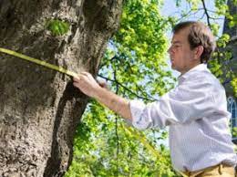
figura 1: Medição do DAP / Reprodução: MLC Consultoria Ambiental
a) Mapping of trees: collection of the number of specimens and location;
b) Annotation of dead tree; when the plant has a dry trunk, without sap flow through the tree;
c) Botanical identification with popular and scientific name;
d) Measurement of DBH (diameter at breast height) – diameter of the crown at a height of 1.30 m from the ground;
e) Verification of the phytosanitary status of the specimen, identifying pests or other problems that may endanger its health;
f) Occurrence of pruning, whether or not there is interfering vegetation, or the occurrence of anthropic processes;
g) Evaluation of the roots.
How is the tree survey carried out in São Paulo?
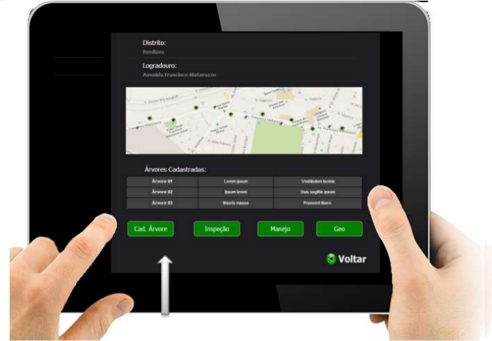
In the case of the Municipality of São Paulo, this survey is carried out with the help of SISGAU – Urban Tree Management System – developed in 2004 by the IPT (Instituto de Pesquisas Tecnológicas). It is a private platform for public agencies that creates a database capable of providing information to other applications, such as GeoSampa, in order to contribute to urban afforestation planning, research and other functions. This platform counts more than 44,000 trees in total.
working of SISGAU/Reproduction: Slides Pref. de São Paulo
How is it done?
In the case of the Municipality of São Paulo, this survey is carried out with the help of SISGAU – Urban Tree Management System – developed in 2004 by the IPT (Instituto de Pesquisas Tecnológicas). It is a private platform for public agencies that creates a database capable of providing information to other applications, such as GeoSampa, in order to contribute to urban afforestation planning, research and other functions. This platform counts more than 44,000 trees in total.
How to access this data?
There are tree survey applications available to any user who has access to the internet, which contribute to the development of research and planning of urban afforestation in each municipality. In this publication, we will address applications and websites that mostly address the city of São Paulo, and that from there can be used as references for the development of applications and research for other municipalities.
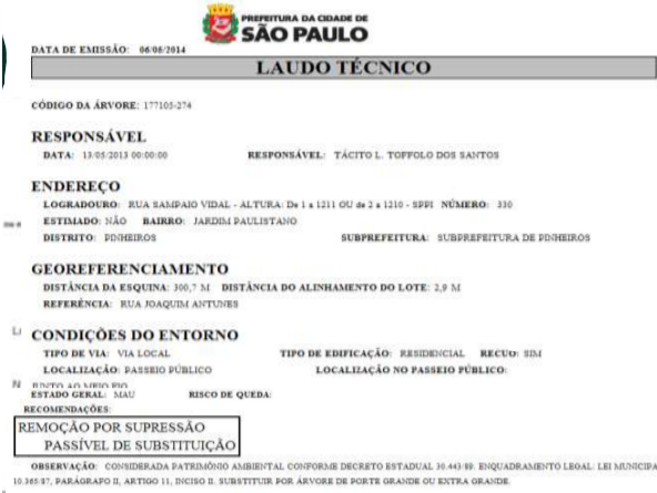
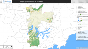
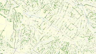
Image 3a e 3b: Site’s interface / Reproduction: GeoSampa’s site
GEOSAMPA
GeoSampa is one of the applications that have a database fed by SISGAU. It is the responsibility of the São Paulo City Hall and, considering tree surveys, the application has information such as the location of areas with remnants of the original biome, with subdivisions and green areas within the municipality, and the location of trees within urban roads, which may contribute to future research, thus creating the centralization of information with long-term results.
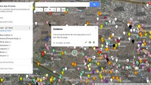
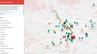
The Tree Inventory is another tree survey application, associated with Google Maps, which has as a differential the participation of the population to contribute to the content of the site, it was developed by Heitor Wegmann Jr., and it is possible to locate on the map where the trees are and read a small entry about each of them, the database is not yet so expressive but it is a great reference for the development of new databases that have the support of the population.
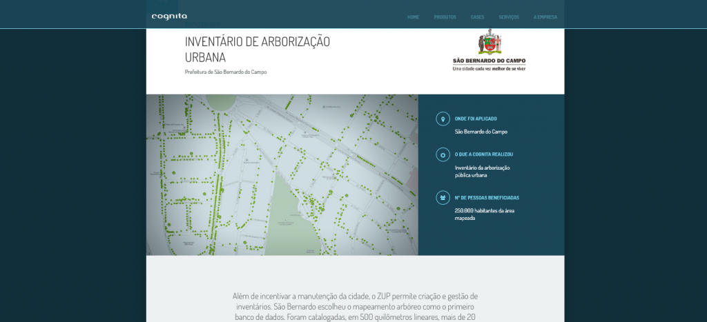
In addition to encouraging the maintenance of the city, the ZUP allows the creation and management of inventories. São Bernardo chose tree mapping as the first database. More than 20,000 trees were catalogued, along 500 linear kilometers, with species identification, visible health problems, among other characteristics.
Tree registration – Grupo SOUL Consultoria Ambiental
Survey that includes botanical identification, diameter at breast height (DBH), woody volume, phytosanitary status, category of threat of extinction, plating of tree individuals and allocation in topographic plant.